Zdejmowana StronaAkumulator
 Modułowa StronaKonstrukcja

 Zautomatyzowane Wykrywanie KanałówWykrywanie Kanałów
 Sygnał GlobalnyPokrycie Sygnałem
 Centymetrowy poziomPozycjonowanie 3D
 Removable
 Modular
 Quick
Quick


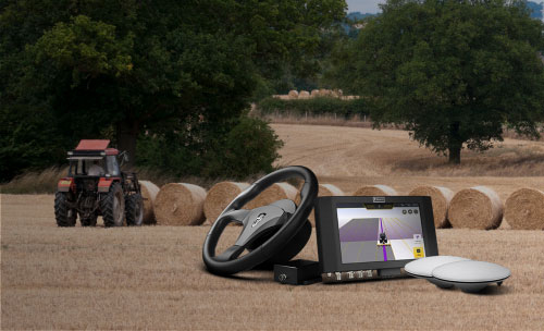
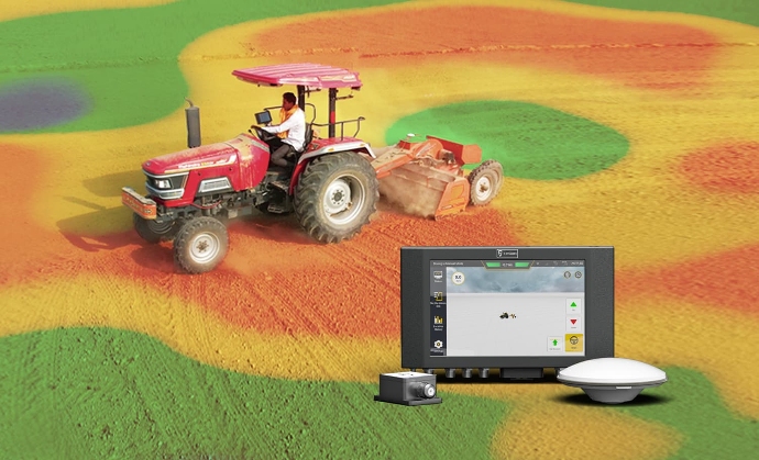
System naprowadzania i sterowania
Dostarczaj niezawodne i precyzyjne sygnały RTK do systemów naprowadzania i sterowania, zapewniając dokładność na poziomie centymetra, która jest niezbędna do optymalizacji działań i poprawy wydajności w gospodarstwie.

Zestaw do Automatycznego Kierowania FJD AT1
Ucz się więcej
System automatycznego sterowania FJD AT2
Ucz się więcej

FJD AH1 Zestaw hydraulicznego układu kierowniczego
Ucz się więcej
System niwelacji terenu